Services
What we do
We manage your field on evidence — from spraying to mapping, every step backed by our agricultural engineers and XAG technology.
Drone spraying and fertilising
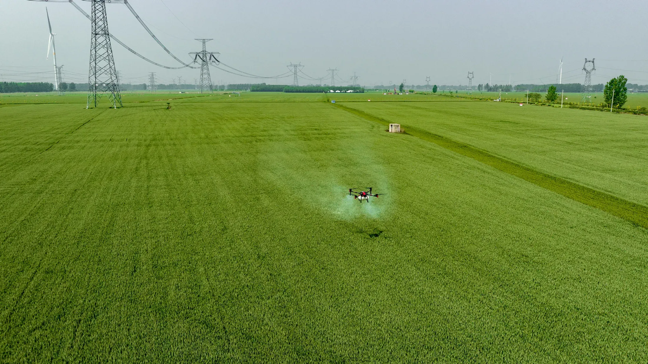
Precise spraying and fertilising decides both yield and cost. Our experienced agricultural engineers and advanced drone fleet build an approach around your land: high-precision RTK GPS drones apply exactly what the field needs, exactly where it needs it, so nothing is wasted.
Rather than treating the whole field the same way, our engineers analyse what the crop actually requires and set the spraying and fertilising programme from there. That avoids unnecessary chemical use, which brings your costs down and makes the work kinder to the land. The drones' high-capacity spraying systems hold an even spread across even the most difficult terrain, so the crop develops at full yield.
Why Skytech Air? Because we do not simply spray a field — we manage it on scientific evidence. Our engineers' agronomic knowledge is what selects the right practice and produces a solution built for that particular field. It raises your productivity while keeping chemical and fertiliser costs to a minimum.
Drone crop analysis
Raising productivity and protecting crop health depend on decisions made from real data. Our drone technology and experienced agricultural engineers scan your fields from the air and return a detailed crop analysis. Fitted with precision sensors and multispectral cameras, the drones detect water stress, nutrient deficiency, disease and pest pressure early enough to act on.
Inspecting an entire field by hand is slow and expensive. High-resolution imaging lets us cover large areas quickly, and our engineers turn what comes back into a report on the field's real condition. You end up knowing precisely which areas need water, fertiliser or protective spraying — and your production gets more efficient for it.
Why Skytech Air? Because we do not just run an analysis, we optimise the whole process against the data. Guided by our engineers, crop health stays at its best, unnecessary cost falls away and output rises. Acting at the right moment is critical to high-quality, sustainable production, and that is the part we manage most closely.
Drone imaging and mapping
Managing and planning farmland well depends on good imaging and mapping. Our advanced drone systems and experienced agricultural engineers scan your fields from the air and deliver detailed mapping and analysis. High-resolution cameras and multispectral sensors capture the terrain, the crop's health and the data that will optimise your production.
Traditional mapping is slow and costly; drones cover large areas quickly and produce a digital map of your land. Those maps show water distribution, soil structure, crop density and productivity levels, so your decisions rest on something solid. Our engineers then read the data and identify which areas need additional attention.
Why Skytech Air? Because we do not just deliver imagery — we put your farm management on an evidential footing. The detailed maps and analysis reports our team prepares let farmers decide with more confidence and run production more efficiently. Good data means the right intervention, and the technology we use is what makes the data trustworthy.
Process
How we work
Five steps between your call and the application, each one grounded in your field's own data.
-
Conversation
We talk through your field, your crop and what you need.
-
Assessment
Our agricultural engineers assess the land, scanning it from the air where needed.
-
Plan
Dose, timing and flight route are set from what the field actually requires.
-
Application
RTK-guided drones carry out the spraying, fertilising or imaging.
-
Report
You get a report on the work done and the data collected.
Frequently asked
What people ask before they call
What services do you offer?
Drone spraying and fertilising, drone crop analysis, and drone imaging and mapping. All three are run together with our in-house agricultural engineers.
What does drone spraying gain me over conventional methods?
Precision spraying only treats the area the crop actually needs, which reduces chemical and fertiliser use. And because no heavy machinery enters the field, there is no soil compaction and no crop crushed under wheels.
How precise is the work?
Our drones fly with RTK GPS, which gives centimetre-level positioning. The XAG APC2 autosteer system we supply for tractors and farm machinery guides to ±2.5 cm.
What does crop analysis show me?
An aerial scan with multispectral cameras reveals the crop's water needs, nutrient deficiency, disease and pest pressure. Our agricultural engineers read that data and report which areas need water, fertiliser or protective spraying.
Do you only provide a service, or do you sell drones too?
Both. We carry out field work with our own team, and we sell the XAG P100 PRO, XAG P150 and XAG APC2.
Which drone models do you work with?
The XAG P100 PRO and XAG P150 spraying drones, plus the XAG APC2 autosteer console for tractors. The P100 PRO carries 50 L of liquid and 80 L of granules; the P150 has a 70 kg payload.
Do I get a report after the work?
Yes. We report on the work carried out and the agricultural data collected; with the mapping service you also receive a digital map of your land.